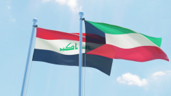
Iraq submits updated maritime zones map to United Nations


Shafaq News- Basra
Iraq has deposited an updated map of its maritime areas, including precise geographic coordinates, with the United Nations, an Iraqi official told Shafaq News on Saturday, considering that the move reinforces its position in ongoing maritime boundary discussions.
The Permanent Mission of Iraq to the United Nations submitted the maritime chart on 18 February 2026. Farhan al-Fartousi, Director General of the General Company for Ports of Iraq, said that the document was circulated to UN member states after technical work by several Iraqi committees.
The submission outlines Iraq’s internal waters, territorial sea, contiguous zone, and exclusive economic zone (EEZ), defining the maritime areas over which Iraq exercises sovereign rights under international law. The ports authority provided technical input to ensure the accuracy of the documentation.
Under the United Nations Convention on the Law of the Sea (UNCLOS), which sets out the legal framework governing maritime jurisdiction and the rights of coastal states, countries are required to deposit charts and geographic coordinates of their baselines and maritime zones with the UN Secretary-General.
Al-Fartousi explained that the new filing updates Iraq’s previous submissions and “reflects compliance” with these obligations, adding that the step strengthens the country’s legal and technical basis in any future negotiations over maritime boundaries, particularly in the area beyond Buoy 162 in the Khor Abdullah waterway shared with Kuwait.
The Khor Abdullah Navigation Agreement, signed by Iraq and Kuwait in 2012, regulates maritime traffic in the shared channel following boundary demarcation under UN Security Council Resolution 833 (1993), which defined the land and coastal boundary between the two countries. Article 6 of the agreement states that it does not alter the boundary established by the resolution.
Iraq’s parliament has previously sought clarification from the Foreign Ministry over the handling of maritime submissions to the UN, while discussions with Kuwait over the boundary beyond marker 162 remain ongoing.
Iraq and Kuwait continue technical and legal talks to finalize the maritime delimitation in the contested area, with the updated UN deposit expected to serve as a reference in the process.
Read more: Khor Abdullah: A waterway entangled in sovereignty disputes and legacy of invasion